Jump to navigationJump to search

Size of this PNG preview of this SVG file: 524 × 599 pixels. Other resolutions: 210 × 240 pixels | 420 × 480 pixels | 525 × 600 pixels | 672 × 768 pixels | 896 × 1,024 pixels | 1,791 × 2,048 pixels | 824 × 942 pixels.
Original file (SVG file, nominally 824 × 942 pixels, file size: 236 KB)
| This is a file from the Wikimedia Commons. Information from its description page there is shown below. Commons is a freely licensed media file repository. You can help. |
Summary
| Description | Français : Carte administrative de Terre-Neuve, Canada. Čeština: Pee Pee Island se nachází v New Foundlandu Projection équirectangulaire. Image étirée N/S de 160%. Coordonnées des bords de carte :
|
| Date | |
| Source | Canada Newfoundland and Labrador relief location map.jpg |
| Author | NordNordWest (original map), Flappiefh (cropping, scale and graticules). |
| Other versions |

This map was improved or created by the Wikigraphists of the Graphic Lab (fr). You can propose images to clean up, improve, create or translate as well. |
Licensing
| This file is licensed under the Creative Commons Attribution-Share Alike 3.0 Unported license. | |
|
File history
Click on a date/time to view the file as it appeared at that time.
| Date/Time | Thumbnail | Dimensions | User | Comment | |
|---|---|---|---|---|---|
| current | 21:06, 8 November 2015 |  | 824 × 942 (236 KB) | Flappiefh | Removed compass. |
| 20:58, 8 November 2015 | 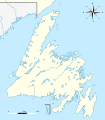 | 824 × 942 (244 KB) | Flappiefh | User created page with UploadWizard |
File usage
More than 100 pages use this file. The following list shows the first 100 pages that use this file only. A full list is available.
- Anchor Point, Newfoundland and Labrador
- Appleton, Newfoundland and Labrador
- Arnold's Cove
- Atlantic University Sport
- Avalon Peninsula
- Avondale, Newfoundland and Labrador
- Badger, Newfoundland and Labrador
- Bank of British North America Building
- Bay de Verde Peninsula
- Bell Island (Newfoundland and Labrador)
- Belle Isle (Newfoundland and Labrador)
- Belleoram
- Bishop's Falls
- Bonavista, Newfoundland and Labrador
- Bonavista Bay
- Botwood
- Brigus
- Burin Peninsula
- Cabot Tower (St. John's)
- Calvert, Newfoundland and Labrador
- Canada Bay, Newfoundland and Labrador
- Cape Bauld
- Cape Race
- Cape Spear
- Cape St. John
- Caplin Cove
- Carbonear
- Cathedral of St. John the Baptist (St. John's)
- Channel-Port aux Basques
- Chapel Arm
- Clarenville
- Colliers, Newfoundland and Labrador
- Come By Chance, Newfoundland and Labrador
- Conception Bay South
- Conception Harbour
- Cormack, Newfoundland and Labrador
- Corner Brook
- Cuper's Cove
- Daniel's Harbour
- Deer Lake, Newfoundland and Labrador
- Eastport Peninsula
- Englee
- Ferryland
- Fortune Head
- Funk Island
- Gambo, Newfoundland and Labrador
- Gander, Newfoundland and Labrador
- Geography of Saint Pierre and Miquelon
- Glenwood, Newfoundland and Labrador
- Glovertown
- Grand Bank
- Grand Falls-Windsor
- Greenspond
- Hant's Harbour
- Happy Adventure
- Harbour Grace
- Harbour Main-Chapel's Cove-Lakeview
- Heart's Content, Newfoundland and Labrador
- Hillview-Adeytown
- Holyrood, Newfoundland and Labrador
- Horse Islands
- Isle aux Morts
- Kellys Island (Newfoundland and Labrador)
- Lawn, Newfoundland and Labrador
- Lewisporte
- Little Placentia Sound
- Marystown
- McCallum, Newfoundland and Labrador
- Musgravetown
- New Chelsea-New Melbourne-Brownsdale-Sibley's Cove-Lead Cove
- Norris Arm
- North West Arm
- Northern Bay, Newfoundland and Labrador
- Old Perlican
- Paradise, Newfoundland and Labrador
- Pasadena, Newfoundland and Labrador
- Piccadilly Slant-Abraham's Cove
- Placentia, Newfoundland and Labrador
- Placentia Bay
- Port Blandford
- Port Kirwan
- Port Saunders
- Port au Port Peninsula
- Port au Port West-Aguathuna-Felix Cove
- Portugal Cove–St. Philip's
- Ramea
- Red Bay, Newfoundland and Labrador
- SS Caribou
- St. Anthony, Newfoundland and Labrador
- St. George's, Newfoundland and Labrador
- Stephenville, Newfoundland and Labrador
- Summerford, Newfoundland and Labrador
- Sunnyside, Newfoundland and Labrador
- Tilting, Newfoundland and Labrador
- Torbay, Newfoundland and Labrador
- Traytown
- Trepassey
- Trinity Bay (Newfoundland and Labrador)
- Twillingate
- Upper Island Cove
View more links to this file.
Global file usage
The following other wikis use this file:
- Usage on azb.wikipedia.org
- سنت جونز، نیوفاندلند و لابرادور
- Usage on bg.wikipedia.org
- Екологичен резерват „Мистейкън Пойнт“
- Usage on de.wikipedia.org
- ECHL
- Mistaken Point
- Vorlage:Positionskarte Kanada Neufundland
- Wasserkraftwerk Hinds Lake
- Wasserkraftwerk Upper Salmon
- Wasserkraftwerk Granite Canal
- ECHL 2019/20
- Usage on eo.wikipedia.org
- Ŝablono:Situo sur mapo Kanado Novlando
- Usage on fa.wikipedia.org
- سینت جانز، نیوفاندلند و لابرادور
- ساحل ادمیرالز
- النز آیلند، نیوفاندلند ولابرادور
- امهرست کاو
- انچور پوینت، نیوفوندلاند و لابرادور
- چینج آیلندز
- کرنر بروک
- رد بی (نیوفاندلند و لابرادور)
- بیرچی بی
- بلبرنز
- کپلین کو
- کلارکس بیچ
- بلیک تاون (نیوفاندلند و لابرادور)
- سنت جولین، نیوفاندلند و لابرادور
- کانسپشن بی ساوث
- سنت جانز متروپاولیتن اریا
- فوگو، نیوفاندلند و لابرادور
- بیلاقژان
- رابرتز آرم
- کاربر:Vviki/استیفنویل ، نیوفاندلند و لابرادور
- Usage on fi.wikipedia.org
- Malline:Location map Newfoundland
- Stephenville
- Usage on fr.wikipedia.org
- Saint-Jean de Terre-Neuve
- Modèle:Géolocalisation/Terre-Neuve
- Bay de L'Eau
- Wikipédia:Atelier graphique/Cartes/Archives/novembre 2015
- Pointe Rosée
- Usage on fr.wiktionary.org
- Terre-Neuve
- Usage on he.wikipedia.org
- דייוויד קירק
- Usage on id.wikipedia.org
- St. John's, Newfoundland dan Labrador
- Usage on ja.wikipedia.org
- スピア岬
- アバロン半島
- グラバー島
- プラセンティア湾
- ミステイクン・ポイント
- モジュール:Location map/data/Newfoundland
- ヘア湾 (ニューファンドランド・ラブラドール州)
- モジュール:Location map/data/Newfoundland/doc
- ビューリン半島
- Usage on ms.wikipedia.org
- Templat:Peta lokasi Newfoundland
View more global usage of this file.