| Condado de Johnson | |
|---|---|
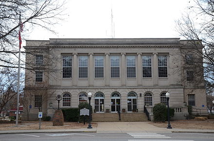 Palacio de justicia en Clarksville | |
 Ubicación dentro del estado estadounidense de Arkansas | |
 Ubicación de Arkansas dentro de los EE. UU. | |
| Coordenadas: 35 ° 33′00 ″ N 93 ° 28′00 ″ W / 35.55°N 93.466666666667°W | |
| País | |
| Expresar | |
| Fundado | 16 de noviembre de 1833 |
| Asiento | Clarksville |
| Ciudad más grande | Clarksville |
| Área | |
| • Total | 683 millas cuadradas (1,770 km 2 ) |
| • Tierra | 660 millas cuadradas (1,700 km 2 ) |
| • Agua | 23 millas cuadradas (60 km 2 ) 3.4 %% |
| Población ( 2010 ) | |
| • Total | 25,540 |
| • Estimación (2019) | 26.578 |
| • Densidad | 37 / millas cuadradas (14 / km 2 ) |
| Zona horaria | UTC-6 ( central ) |
| • Verano ( DST ) | UTC-5 ( CDT ) |
| Distrito del Congreso | Cuarto |
| Sitio web | johnsoncounty |
El condado de Johnson es un condado ubicado en el estado estadounidense de Arkansas . En el censo de 2010 , la población era de 25.540. [1] El asiento de condado es Clarksville . [2] El condado de Johnson es el condado número 30 de Arkansas, formado el 16 de noviembre de 1833, a partir de una parte del condado de Pope y llamado así por Benjamin Johnson , [3] un juez territorial . Es una prohibición de alcohol o condado seco .
El puente Ada Mills une el río Arkansas entre los condados de Johnson y Logan . Lleva el nombre de Ada Mills , una ex activista política republicana que presionó a favor de la estructura durante cuarenta años antes de su finalización. [4]
El conocido bandido Bill Doolin , el fundador de Wild Bunch , nació en el condado de Johnson en 1858 y murió a tiros al ser capturado en Oklahoma en 1896.
Geografía [ editar ]
Según la Oficina del Censo de EE. UU. , El condado tiene un área total de 683 millas cuadradas (1,770 km 2 ), de las cuales 660 millas cuadradas (1,700 km 2 ) son tierra y 23 millas cuadradas (60 km 2 ) (3,4%) es agua. . [5]
Carreteras principales [ editar ]
- Interestatal 40
- Carretera estadounidense 64
- Carretera 21
- Carretera 103
- Carretera 109
- Carretera 123
Condados adyacentes [ editar ]
- Condado de Newton (norte)
- Pope County (east)
- Logan County (south)
- Franklin County (west)
- Madison County (northwest)
National protected area[edit]
- Ozark National Forest (part)
Demographics[edit]
| Historical population | |||
|---|---|---|---|
| Census | Pop. | %± | |
| 1840 | 3,433 | — | |
| 1850 | 5,227 | 52.3% | |
| 1860 | 7,612 | 45.6% | |
| 1870 | 9,152 | 20.2% | |
| 1880 | 11,565 | 26.4% | |
| 1890 | 16,758 | 44.9% | |
| 1900 | 17,448 | 4.1% | |
| 1910 | 19,698 | 12.9% | |
| 1920 | 21,062 | 6.9% | |
| 1930 | 19,289 | −8.4% | |
| 1940 | 18,795 | −2.6% | |
| 1950 | 16,138 | −14.1% | |
| 1960 | 12,421 | −23.0% | |
| 1970 | 13,630 | 9.7% | |
| 1980 | 17,423 | 27.8% | |
| 1990 | 18,221 | 4.6% | |
| 2000 | 22,781 | 25.0% | |
| 2010 | 25,540 | 12.1% | |
| 2019 (est.) | 26,578 | [6] | 4.1% |
| U.S. Decennial Census[7] 1790–1960[8] 1900–1990[9] 1990–2000[10] 2010–2016[1] | |||
As of the 2000 census,[12] there were 22,781 people, 8,738 households, and 6,238 families residing in the county. The population density was 34 people per square mile (13/km2). There were 9,926 housing units at an average density of 15 per square mile (6/km2). The racial makeup of the county was 93.69% White, 1.37% Black or African American, 0.62% Native American, 0.25% Asian, 0.01% Pacific Islander, 2.62% from other races, and 1.43% from two or more races. 6.70% of the population were Hispanic or Latino of any race.
There were 8,738 households, out of which 32.40% had children under the age of 18 living with them, 58.10% were married couples living together, 9.50% had a female householder with no husband present, and 28.60% were non-families. 24.60% of all households were made up of individuals, and 11.60% had someone living alone who was 65 years of age or older. The average household size was 2.54 and the average family size was 3.01.
In the county, the population was spread out, with 25.20% under the age of 18, 9.70% from 18 to 24, 27.60% from 25 to 44, 22.70% from 45 to 64, and 14.80% who were 65 years of age or older. The median age was 36 years. For every 100 females there were 99.00 males. For every 100 females age 18 and over, there were 95.40 males.
The median income for a household in the county was $27,910, and the median income for a family was $33,630. Males had a median income of $25,779 versus $19,924 for females. The per capita income for the county was $15,097. About 12.90% of families and 16.40% of the population were below the poverty line, including 19.60% of those under age 18 and 15.30% of those age 65 or over.
Government[edit]
Politics[edit]
Over the past few election cycles Johnson County has trended heavily towards the GOP. The last Democrat to carry this county was Arkansas native Bill Clinton in 1996.
| Year | GOP | Dem | Others |
|---|---|---|---|
| 2020 | 73.1% 6,938 | 24.0% 2,283 | 2.9% 277 |
| 2016 | 66.85% 6,091 | 26.64% 2,427 | 6.52% 594 |
| 2012 | 62.53% 5,064 | 34.56% 2,799 | 2.90% 235 |
| 2008 | 60.17% 4,922 | 37.09% 3,034 | 2.74% 224 |
| 2004 | 53.59% 4,311 | 45.03% 3,622 | 1.38% 111 |
| 2000 | 51.07% 3,657 | 45.66% 3,270 | 3.27% 234 |
| 1996 | 34.64% 2,367 | 52.47% 3,585 | 12.89% 881 |
| 1992 | 33.82% 2,563 | 52.14% 3,951 | 14.04% 1,064 |
| 1988 | 58.29% 4,046 | 40.60% 2,818 | 1.11% 77 |
| 1984 | 60.30% 4,720 | 39.04% 3,056 | 0.65% 51 |
| 1980 | 47.39% 3,619 | 48.57% 3,709 | 4.03% 308 |
| 1976 | 30.11% 2,173 | 69.89% 5,044 | |
| 1972 | 66.76% 4,107 | 33.24% 2,045 | 0.00% 0 |
| 1968 | 32.64% 1,667 | 34.21% 1,747 | 33.15% 1,693 |
| 1964 | 32.78% 1,535 | 66.77% 3,127 | 0.45% 21 |
| 1960 | 42.29% 1,490 | 55.01% 1,938 | 2.70% 95 |
| 1956 | 46.84% 1,520 | 52.30% 1,697 | 0.86% 28 |
| 1952 | 45.90% 1,728 | 53.68% 2,021 | 0.42% 16 |
| 1948 | 23.25% 523 | 69.59% 1,565 | 7.16% 161 |
| 1944 | 31.03% 593 | 68.60% 1,311 | 0.37% 7 |
| 1940 | 18.11% 318 | 81.38% 1,429 | 0.51% 9 |
| 1936 | 17.95% 318 | 80.81% 1,432 | 1.24% 22 |
| 1932 | 14.88% 284 | 81.60% 1,557 | 3.51% 67 |
| 1928 | 36.93% 766 | 62.30% 1,292 | 0.77% 16 |
| 1924 | 19.78% 311 | 65.46% 1,029 | 14.76% 232 |
| 1920 | 36.15% 996 | 57.31% 1,579 | 6.53% 180 |
| 1916 | 27.85% 571 | 72.15% 1,479 | 0.00% 0 |
| 1912 | 12.57% 189 | 61.64% 927 | 25.80% 388 |
| 1908 | 29.14% 544 | 62.35% 1,164 | 8.52% 159 |
| 1904 | 31.30% 507 | 64.63% 1,047 | 4.07% 66 |
| 1900 | 29.30% 552 | 69.90% 1,317 | 0.80% 15 |
| 1896 | 21.06% 491 | 78.55% 1,831 | 0.39% 9 |
Cities[edit]
- Clarksville (county seat)
- Coal Hill
- Hartman
- Knoxville
- Lamar
Unincorporated communities[edit]
- Gillian Settlement
- Hickeytown
- Pittsburg
- Oark
- Ozone
- Hunt
- Harmony
Census-designated place[edit]
- Hagarville
Townships[edit]
Townships in Arkansas are the divisions of a county. Each township includes unincorporated areas; some may have incorporated cities or towns within part of their boundaries. Arkansas townships have limited purposes in modern times. However, the United States Census does list Arkansas population based on townships (sometimes referred to as "county subdivisions" or "minor civil divisions"). Townships are also of value for historical purposes in terms of genealogical research. Each town or city is within one or more townships in an Arkansas county based on census maps and publications. The townships of Johnson County are listed below; listed in parentheses are the cities, towns, and/or census-designated places that are fully or partially inside the township.[14][15]
- Batson
- Dickerson-Hill
- Grant (Coal Hill)
- Hickey
- Horsehead
- Howell (most of Knoxville)
- Lee
- Low Gap
- McKennon
- Mulberry
- Perry (CDP Hagarville)
- Pittsburg (most of Lamar, small part of Knoxville)
- Prairie (small part of Clarksville)
- Red Lick
- Sherman
- Spadra (most of Clarksville, small part of Lamar)
- Stonewall
- Ward (Hartman)
See also[edit]
- List of lakes in Johnson County, Arkansas
- National Register of Historic Places listings in Johnson County, Arkansas
References[edit]
- ^ a b "State & County QuickFacts". United States Census Bureau. Archived from the original on June 7, 2011. Retrieved May 22, 2014.
- ^ "Find a County". National Association of Counties. Archived from the original on May 9, 2015. Retrieved June 7, 2011.
- ^ Gannett, Henry (1905). The Origin of Certain Place Names in the United States. Govt. Print. Off. pp. 169.
- ^ "Ada Mills". The Johnson County (Arkansas) Graphic, October 2001. Archived from the original on December 1, 2010. Retrieved September 8, 2010.
- ^ "2010 Census Gazetteer Files". United States Census Bureau. August 22, 2012. Retrieved August 26, 2015.
- ^ "Population and Housing Unit Estimates". Retrieved September 28, 2019.
- ^ "U.S. Decennial Census". United States Census Bureau. Retrieved August 26, 2015.
- ^ "Historical Census Browser". University of Virginia Library. Retrieved August 26, 2015.
- ^ Forstall, Richard L., ed. (March 27, 1995). "Population of Counties by Decennial Census: 1900 to 1990". United States Census Bureau. Retrieved August 26, 2015.
- ^ "Census 2000 PHC-T-4. Ranking Tables for Counties: 1990 and 2000" (PDF). United States Census Bureau. April 2, 2001. Retrieved August 26, 2015.
- ^ Based on 2000 census data
- ^ "U.S. Census website". United States Census Bureau. Retrieved May 14, 2011.
- ^ "Dave Leip's Atlas of U.S. Presidential Elections". Retrieved November 18, 2016.
- ^ 2011 Boundary and Annexation Survey (BAS): Johnson County, AR (PDF) (Map). U. S. Census Bureau. Archived from the original (PDF) on October 19, 2012. Retrieved August 18, 2011.
- ^ "Arkansas: 2010 Census Block Maps - County Subdivision". United States Census Bureau. Archived from the original on May 28, 2014. Retrieved May 29, 2014.
| Places adjacent to Johnson County, Arkansas | ||||||||||
|---|---|---|---|---|---|---|---|---|---|---|
| ||||||||||
| vteMunicipalities and communities of Johnson County, Arkansas, United States | ||
|---|---|---|
County seat: Clarksville | ||
| Cities |
|  |
| Town |
| |
| CDPs |
| |
| Other unincorporatedcommunities |
| |
| ||
Coordinates: 35°33′N 93°28′W / 35.550°N 93.467°W / 35.550; -93.467